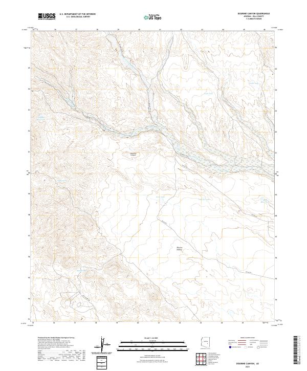
2021 Map of Dourine Canyon
USGS Topo · Published 2021About this map
Dourine Canyon and the surrounding high desert of Gila County are defined by a complex network of seasonal water drainage and cattle-raising infrastructure. The landscape is dominated by the broad course of Sevenmile Wash, which receives smaller tributaries like Champion Cr. This 2021 survey illustrates a region largely dedicated to open range, as evidenced by Dourine Pasture and a high density of named water catchments vital for livestock in this arid environment. Significant water features such as Indian Spring, Metate Tank, and Steer Tank are dispersed across the township and range grids, connected by Bureau of Indian Affairs routes including Bia RD 900 and Bia RD 903. The presence of Skill Center Rd in the southern portion of the map suggests modern development patterns intersecting with the traditional land use of the Dourine area.
Find a feature on this map
24 named features on this map. Tap any name to fly to it.
Don’t see what you’re looking for? This feature index may not catch every label — zoom into the map to look around manually.
Map Details
Editions of this 2021 Dourine Canyon Map
This is the sole edition of this map. No revisions or reprints were ever made.
Other maps of this area

1922 · Chrysotile
USGS Topo · 1:125,000

1954 · Mesa
USGS Topo · 1:250,000

1957 · Mesa
USGS Topo · 1:250,000

1958 · Mesa
USGS Topo · 1:250,000

1960 · Mesa
USGS Topo · 1:250,000

1964 · Mesa
USGS Topo · 1:250,000

1965 · Bucket Mtn
USGS Topo · 1:24,000

1966 · Natural Corral
USGS Topo · 1:24,000
1966 · Dourine Canyon
USGS Topo · 1:24,000

1966 · Cassadore Spring
USGS Topo · 1:24,000