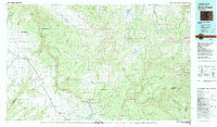
1982 Map of Dove Creek
USGS Topo · Published 1982About this map
McPhee Dam stands as a massive engineering project in progress along the Dolores River on this 1982 map of southwestern Colorado. The landscape transitions from the agricultural plateaus near Dove Creek and Pleasant View into the canyon-carved terrain of Hovenweep Canyon and Sandstone Canyon. In the high country to the east, mining activity is evident with the Effie B Mine, Sarah Ellen Mine, and Minnie Jean Mine located near Spud Patch Camp. This survey documents the region just before the completion of the McPhee Reservoir, which would significantly alter the hydrology and local geography of the area. The map also traces the high-altitude reaches of the Uncompahgre National Forest and the dramatic relief of Lone Cone and Dolores Peak.
Find a feature on this map
70 named features on this map. Tap any name to fly to it.
Don’t see what you’re looking for? This feature index may not catch every label — zoom into the map to look around manually.
Map Details
Editions of this 1982 Dove Creek Map
This is the sole edition of this map. No revisions or reprints were ever made.
Other maps of this area

1885 · La Sal
USGS Topo · 1:250,000

1886 · Abajo
USGS Topo · 1:250,000

1892 · Abajo
USGS Topo · 1:250,000

1893 · Abajo
USGS Topo · 1:250,000

1895 · La Plata
USGS Topo · 1:62,500

1897 · La Plata
USGS Topo · 1:62,500

1897 · Rico
USGS Topo · 1:62,500

1897 · Telluride
USGS Topo · 1:62,500

1898 · Durango
USGS Topo · 1:62,500

1898 · Engineer Mountain
USGS Topo · 1:62,500