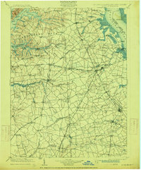
1906 Map of Dover
USGS Topo · Published 1915About this map
St. Augustine Light and Bombay Hook Light stand as critical maritime markers along the western shore of the Delaware River, overlooking a landscape defined by deep tidal inlets and neck-based settlements. The peninsula between the Elk River and Sassafras River is divided into geographic landmarks like Pearce Neck and Grove Neck, reflecting an era where water access dictated local commerce. Inland, the arrival of the Delaware RR and the Philadelphia Baltimore and Washington RR began shifting the economic center toward towns like Middletown and Townsend. A series of historic landings, such as Stave Ldg. and Fennimore Ldg., highlight the transition points where farm goods met the river. This survey captures the complex boundary network of the Delmarva Peninsula, including the jagged Maryland Delaware border and the marshes of Thoroughfare Neck.
Find a feature on this map
156 named features on this map. Tap any name to fly to it.
Don’t see what you’re looking for? This feature index may not catch every label — zoom into the map to look around manually.
Map Details
Editions of this 1906 Dover Map
3 editions found

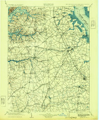
Other maps of this area

1890 · Salem
USGS Topo · 1:62,500

1890 · Bay Side
USGS Topo · 1:62,500

1894 · Bay Side
USGS Topo · 1:62,500

1898 · Choptank
USGS Topo · 1:125,000

1898 · Salem
USGS Topo · 1:62,500

1898 · Elkton
USGS Topo · 1:62,500

1898 · Tolchester
USGS Topo · 1:125,000

1899 · Vineland
USGS Topo · 1:125,000

1899 · Dover
USGS Topo · 1:125,000

1900 · Elkton
USGS Topo · 1:62,500