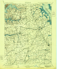
1906 Map of Dover
USGS Topo · Published 1929About this map
Smyrna and the state capital of Dover anchor this early 20th-century survey of the Delmarva Peninsula, where the colonial-era geography of the upper Chesapeake and Delaware Bay remains remarkably visible. The landscape is defined by the intricate "necks" of land, such as Pond Neck and Thoroughfare Neck, carved out by tidal rivers and creeks. A robust maritime economy is evident along the Delaware River shoreline, dotted with landings like Thomas Ldg. and Stave Ldg., alongside navigation aids including the Bombay Hook Light.
Find a feature on this map
173 named features on this map. Tap any name to fly to it.
Don’t see what you’re looking for? This feature index may not catch every label — zoom into the map to look around manually.
Map Details
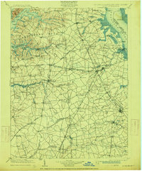
Editions of this 1906 Dover Map
3 editions found

Other maps of this area

1890 · Salem
USGS Topo · 1:62,500

1890 · Bay Side
USGS Topo · 1:62,500

1894 · Bay Side
USGS Topo · 1:62,500

1898 · Choptank
USGS Topo · 1:125,000

1898 · Salem
USGS Topo · 1:62,500

1898 · Elkton
USGS Topo · 1:62,500

1898 · Tolchester
USGS Topo · 1:125,000

1899 · Vineland
USGS Topo · 1:125,000

1899 · Dover
USGS Topo · 1:125,000

1900 · Elkton
USGS Topo · 1:62,500