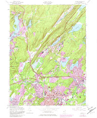
1954 Map of Dover
USGS Topo · Published 1982About this map
The Picatinny Arsenal occupies a significant portion of this northern New Jersey landscape, situated between Green Pond Mountain and Mase Mountain. This 1954 revision, updated with purple-tinted urban expansions in the early 1980s, highlights the industrial and military legacy of the Rockaway Valley. Evidence of the region's iron mining history is visible at the Richard Mine and Mount Hope Mine, while the southern corridor through Dover and Wharton shows dense residential development and established community structures like St Marys Cem and the Morris Hills Sch. The northern reaches of the map transition into the recreational and environmental zones of Lake Hopatcong and the Berkshire Valley Wildlife Management Area. Transport infrastructure is dominated by the Conrail lines and numerous interchanges along the evolving highway system, reflecting the area's role as a vital hub in Morris County.
Find a feature on this map
82 named features on this map. Tap any name to fly to it.
Don’t see what you’re looking for? This feature index may not catch every label — zoom into the map to look around manually.
Map Details
Editions of this 1954 Dover Map
5 editions found

Other maps of this area

1888 · Franklin
USGS Topo · 1:62,500

1888 · Morristown
USGS Topo · 1:62,500

1888 · Lake Hopatcong
USGS Topo · 1:62,500

1891 · Greenwood Lake
USGS Topo · 1:62,500

1893 · Greenwood Lake
USGS Topo · 1:62,500

1894 · Morristown
USGS Topo · 1:62,500

1894 · Lake Hopatcong
USGS Topo · 1:62,500

1894 · Franklin
USGS Topo · 1:62,500

1897 · Franklin
USGS Topo · 1:62,500

1898 · Lake Hopatcong
USGS Topo · 1:62,500