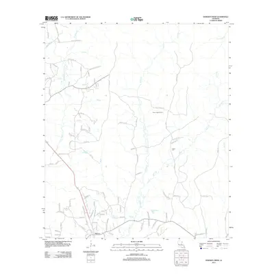
2012 Map of Dowden Creek
USGS Topo · Published 2012About this map
Anacoco serves as the primary settlement hub in this part of Vernon Parish, situated where several creeks and branches converge. The landscape is defined by its complex drainage network, including the W Anacoco Cr and E Anacoco Cr forks, alongside numerous tributaries like Big Br and Dowden Cr. These waterways historically dictated the placement of early homesteads and roads. To the north, the Peason Ridge Oil Field indicates the region's industrial connection to petroleum extraction, while local history remains preserved at sites such as McInnis Cem. A dense network of parish roads, such as Oak Grove Church Rd and Roy Lee Snell Rd, connects dispersed rural residences to the main town center, reflecting the late 20th-century expansion of rural infrastructure into the piney woods and creek bottoms.
Find a feature on this map
100 named features on this map. Tap any name to fly to it.
Don’t see what you’re looking for? This feature index may not catch every label — zoom into the map to look around manually.
Map Details
Editions of this 2012 Dowden Creek Map
This is the sole edition of this map. No revisions or reprints were ever made.
Other maps of this area

1941 · Leesville
USGS Topo · 1:62,500

1941 · Slagle
USGS Topo · 1:62,500

1942 · Florien
USGS Topo · 1:62,500

1942 · Kisatchie
USGS Topo · 1:62,500

1943 · Leesville
USGS Topo · 1:62,500

1943 · Kisatchie
USGS Topo · 1:62,500

1944 · Florien
USGS Topo · 1:62,500

1944 · Slagle
USGS Topo · 1:62,500

1946 · Leesville
USGS Topo · 1:62,500

1948 · Leesville
USGS Topo · 1:62,500