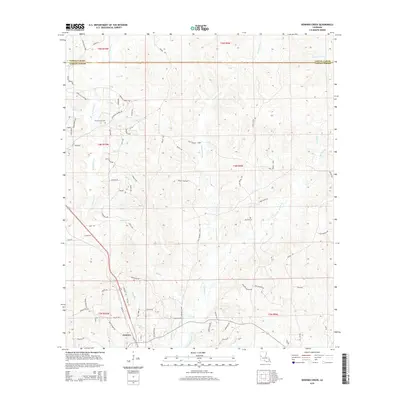
2015 Map of Dowden Creek
USGS Topo · Published 2015About this map
Anacoco serves as a central hub in this landscape where the boundary between Sabine Parish and Vernon Parish meets. The terrain is defined by an intricate network of waterways, including Dowden Creek, W Anacoco Cr, and E Anacoco Cr, which dictate the placement of local infrastructure. For those researching family history in the region, the map identifies significant sites such as Union Grove Cem and McInnis Cem. The rural road network is marked by family-named routes like Prewitts Chapel Rd, Spears Rd, and Clyde Miller Rd, reflecting the long-standing land-use patterns of these Louisiana parishes. The map illustrates how local life follows the draws and branches of the creek systems, with numerous small crossings and loops like Gum Springs Loop and Mennis Loop Rd connecting dispersed homesteads to the primary thoroughfares.
Find a feature on this map
82 named features on this map. Tap any name to fly to it.
Don’t see what you’re looking for? This feature index may not catch every label — zoom into the map to look around manually.
Map Details
Editions of this 2015 Dowden Creek Map
This is the sole edition of this map. No revisions or reprints were ever made.
Other maps of this area

1941 · Leesville
USGS Topo · 1:62,500

1941 · Slagle
USGS Topo · 1:62,500

1942 · Florien
USGS Topo · 1:62,500

1942 · Kisatchie
USGS Topo · 1:62,500

1943 · Leesville
USGS Topo · 1:62,500

1943 · Kisatchie
USGS Topo · 1:62,500

1944 · Florien
USGS Topo · 1:62,500

1944 · Slagle
USGS Topo · 1:62,500

1946 · Leesville
USGS Topo · 1:62,500

1948 · Leesville
USGS Topo · 1:62,500