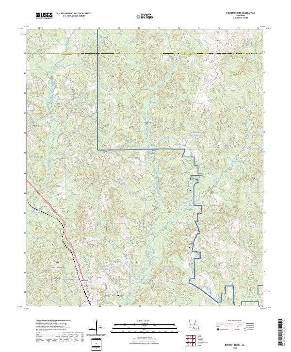
2024 Map of Dowden Creek
USGS Topo · Published 2024About this map
Anacoco serves as the primary settlement hub in this rural stretch of western Louisiana, situated where local roads converge near the southern boundary of Sabine Parish and Vernon Parish. The landscape is dominated by the sprawling Peason Ridge Training Area and portions of Fort Polk, highlighting the long-standing military presence in the region. Numerous family-named cemeteries, including Union Grove Cem, McInnis Cem, and Mitchell Cem, are scattered throughout the wooded terrain, providing valuable touchpoints for genealogical research. The complex hydrology is defined by the winding paths of West Anacoco Creek and East Anacoco Creek, which are fed by dozens of smaller tributaries like Swinley Branch and Coon Branch. This contemporary survey illustrates the persistent rural character of the area, where timber and military training grounds coexist with small community landmarks and old parish roads.
Find a feature on this map
76 named features on this map. Tap any name to fly to it.
Don’t see what you’re looking for? This feature index may not catch every label — zoom into the map to look around manually.
Map Details
Editions of this 2024 Dowden Creek Map
This is the sole edition of this map. No revisions or reprints were ever made.
Other maps of this area

1941 · Leesville
USGS Topo · 1:62,500

1941 · Slagle
USGS Topo · 1:62,500

1942 · Florien
USGS Topo · 1:62,500

1942 · Kisatchie
USGS Topo · 1:62,500

1943 · Leesville
USGS Topo · 1:62,500

1943 · Kisatchie
USGS Topo · 1:62,500

1944 · Florien
USGS Topo · 1:62,500

1944 · Slagle
USGS Topo · 1:62,500

1946 · Leesville
USGS Topo · 1:62,500

1948 · Leesville
USGS Topo · 1:62,500