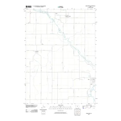
2010 Map of Dows West
USGS Topo · Published 2010About this map
The Iowa River meanders through this agricultural landscape, forming the central geographic spine for the communities of Rowan, Galt, and Dows. This 2010 survey illustrates a highly managed rural environment, where the natural watercourse is supplemented by an extensive network of drainage infrastructure, including Ditch Number 187, Ditch Number 213, and Ditch Number 55. These features reflect the long-term engineering required to maintain the productivity of the Iowa prairie.
Find a feature on this map
36 named features on this map. Tap any name to fly to it.
Don’t see what you’re looking for? This feature index may not catch every label — zoom into the map to look around manually.
Map Details
Editions of this 2010 Dows West Map
This is the sole edition of this map. No revisions or reprints were ever made.
Other maps of this area

1954 · Waterloo
USGS Topo · 1:250,000

1955 · Waterloo
USGS Topo · 1:250,000

1972 · Cornelia
USGS Topo · 1:24,000

1972 · Alexander
USGS Topo · 1:24,000

1972 · Belmond
USGS Topo · 1:24,000

1978 · Clarion
USGS Topo · 1:24,000

1978 · Sheldon Creek
USGS Topo · 1:24,000

1978 · Dows West
USGS Topo · 1:24,000

1978 · Clarion SW
USGS Topo · 1:24,000

1979 · Dows East
USGS Topo · 1:24,000