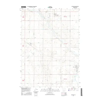
2015 Map of Dows West
USGS Topo · Published 2015About this map
The Iowa River meanders diagonally across this North Central Iowa landscape, serving as a primary geographical axis for the agricultural communities of Wright and Franklin counties. In the northwest, the town of Rowan is oriented around a traditional grid featuring Main St and Broadway St, while the community of Galt sits further south along Co Rd R59. The map details a sophisticated network of water management, evidenced by numerous numbered drainage features such as Ditch Number 213 and Ditch Number 187, which reflect the region's long-term conversion of wetlands into productive farmland. Genealogists will find several notable burial sites documented, including Graceland Cem near Rowan, Galt Cem, and Fairview Cem on the outskirts of Dows. This 2015 survey provides a comprehensive view of the rural township structure, defined by clear section lines and a grid of country roads like Thompson Ave and Taylor Ave.
Find a feature on this map
60 named features on this map. Tap any name to fly to it.
Don’t see what you’re looking for? This feature index may not catch every label — zoom into the map to look around manually.
Map Details
Editions of this 2015 Dows West Map
This is the sole edition of this map. No revisions or reprints were ever made.
Other maps of this area

1954 · Waterloo
USGS Topo · 1:250,000

1955 · Waterloo
USGS Topo · 1:250,000

1972 · Cornelia
USGS Topo · 1:24,000

1972 · Alexander
USGS Topo · 1:24,000

1972 · Belmond
USGS Topo · 1:24,000

1978 · Clarion
USGS Topo · 1:24,000

1978 · Sheldon Creek
USGS Topo · 1:24,000

1978 · Dows West
USGS Topo · 1:24,000

1978 · Clarion SW
USGS Topo · 1:24,000

1979 · Dows East
USGS Topo · 1:24,000