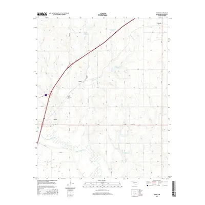
2016 Map of Doxey
USGS Topo · Published 2016About this map
Merritt anchors the northeastern corner of this Beckham County landscape, where the flat upland plains begin their descent toward the winding hydrology of the South Canadian River watershed. This 2016 survey shows a region defined by its grid-based agricultural parcels and the modern transit corridors that have shaped local movement. While largely characterized by open terrain, the map reveals the complex drainage patterns of intermittent creeks and seasonal watercourses that intersect the section lines, reflecting the traditional land division of the Oklahoma prairie. This modern topographic study provides an essential look at the contemporary footprint of local roads and water management features that continue to support the area's rural economy.
Find a feature on this map
1 named feature on this map. Tap any name to fly to it.
Don’t see what you’re looking for? This feature index may not catch every label — zoom into the map to look around manually.
Map Details
Editions of this 2016 Doxey Map
This is the sole edition of this map. No revisions or reprints were ever made.
Other maps of this area

1955 · Clinton
USGS Topo · 1:250,000

1957 · Clinton
USGS Topo · 1:250,000

1960 · Sayre
USGS Topo · 1:62,500

1961 · Willow
USGS Topo · 1:62,500

1961 · Retrop
USGS Topo · 1:62,500

1961 · Elk City
USGS Topo · 1:62,500

1985 · Elk City
USGS Topo · 1:100,000

1987 · Elk City
USGS Topo · 1:24,000
1987 · Hocker
USGS Topo · 1:24,000
1989 · Carter West
USGS Topo · 1:24,000