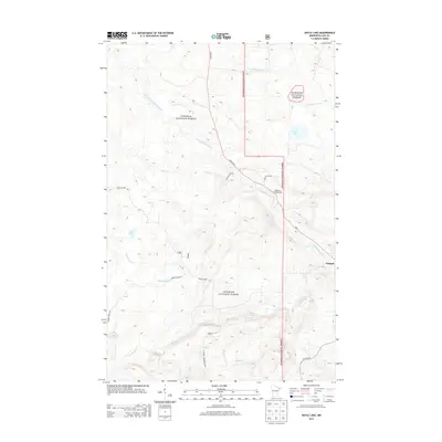
2013 Map of Doyle Lake
USGS Topo · Published 2013About this map
The unincorporated community of Finland stands as the primary hub in this portion of the Superior National Forest, located near the intersection of State Hwy 1 and Lax Lake Rd. The landscape is defined by the headwaters and branches of the Baptism River, including the E Br Baptism River and W Br Baptism River. These waterways, along with drainage from Heffelfinger Cr and Crown Cr, reveal a complex drainage pattern through the North Shore highland. Recreational and utility routes are prominent, from the Wildhurst Campgrounds to the N Shore Snowmobile Trl, illustrating the area's transition toward a recreation-based economy. The presence of Doyle Lake and Fry Lake amidst numerous named creeks like Nicado Cr and Hockamin Cr highlights the water-rich topography that has shaped settlement and travel in Lake County.
Find a feature on this map
20 named features on this map. Tap any name to fly to it.
Don’t see what you’re looking for? This feature index may not catch every label — zoom into the map to look around manually.
Map Details
Editions of this 2013 Doyle Lake Map
This is the sole edition of this map. No revisions or reprints were ever made.
Other maps of this area

1954 · Silver Bay
USGS Topo · 1:62,500

1954 · Two Harbors
USGS Topo · 1:250,000

1955 · Isabella
USGS Topo · 1:62,500

1955 · Cramer
USGS Topo · 1:62,500

1956 · Finland
USGS Topo · 1:24,000

1956 · Finland
USGS Topo · 1:62,500

1956 · Illgen City
USGS Topo · 1:24,000

1957 · Two Harbors
USGS Topo · 1:250,000

1958 · Two Harbors
USGS Topo · 1:250,000

1964 · Two Harbors
USGS Topo · 1:250,000