
1954 Map of Doyle
USGS Topo · Published 1956About this map
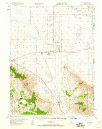
Sierra Ordnance Depot dominates the valley floor in this 1954 survey, reflecting the mid-century military presence in Lassen County. The surrounding landscape is a complex mix of high-desert logistics and rugged mountain terrain, where the Military Reservation sits adjacent to the emerging community of Herlong. To the south, the Bird Hills and Turtle Mtn rise sharply above Long Valley, which serves as a natural corridor for the Western Pacific and Southern Pacific railroads.
Find a feature on this map
53 named features on this map. Tap any name to fly to it.
Don’t see what you’re looking for? This feature index may not catch every label — zoom into the map to look around manually.
Map Details
Editions of this 1954 Doyle Map
3 editions found
Other maps of this area

1886 · Honey Lake
USGS Topo · 1:250,000

1886 · Granite Range
USGS Topo · 1:250,000

1890 · Sierraville
USGS Topo · 1:125,000

1891 · Honey Lake
USGS Topo · 1:250,000

1891 · Reno
USGS Topo · 1:125,000

1892 · Sierraville
USGS Topo · 1:125,000

1893 · Honey Lake
USGS Topo · 1:250,000

1893 · Reno
USGS Topo · 1:125,000

1894 · Granite Range
USGS Topo · 1:250,000

1894 · Sierraville
USGS Topo · 1:125,000