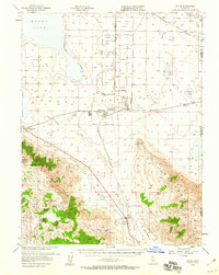
1954 Map of Doyle
USGS Topo · Published 1960About this map
The Sierra Ordnance Depot dominates the desert flats north of the Fort Sage Mountains, a stark contrast to the shifting shoreline of Honey Lake and the high peaks of the Plumas National Forest. This mid-century survey captures the industrial and military footprint in the high desert, centered around the settlement of Herlong and its logistical connections. The Southern Pacific and Western Pacific railroads intersect near the state line, facilitating the movement of materials through this arid corridor. To the south, the landscape rises sharply into the Bird Hills and toward McKesick Peak, where the Meadow View Guard Sta and various springs like Bird Flat Spring highlight the essential water sources for cattle and forestry operations. This map serves as a detailed record of the infrastructure supporting both the military installation and the remote ranching communities at Stacy, Calneva, and Doyle.
Find a feature on this map
56 named features on this map. Tap any name to fly to it.
Don’t see what you’re looking for? This feature index may not catch every label — zoom into the map to look around manually.
Map Details
Editions of this 1954 Doyle Map
3 editions found

Other maps of this area

1886 · Honey Lake
USGS Topo · 1:250,000

1886 · Granite Range
USGS Topo · 1:250,000

1890 · Sierraville
USGS Topo · 1:125,000

1891 · Honey Lake
USGS Topo · 1:250,000

1891 · Reno
USGS Topo · 1:125,000

1892 · Sierraville
USGS Topo · 1:125,000

1893 · Honey Lake
USGS Topo · 1:250,000

1893 · Reno
USGS Topo · 1:125,000

1894 · Granite Range
USGS Topo · 1:250,000

1894 · Sierraville
USGS Topo · 1:125,000