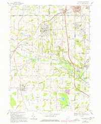
1969 Map of Doylestown
USGS Topo · Published 1978About this map
Doylestown sits at the center of this detailed survey, surrounded by the agricultural and industrial landscape of Wayne and Summit counties. The area's mid-century development is visible through the expansion of major thoroughfares like U S 21 and the construction of Chippewa High Sch. A defining industrial feature is the Chippewa Underground Gas Storage Field, which spans a significant portion of the Chippewa Creek valley. This intersection of energy infrastructure and rural life is further evidenced by the many gas wells scattered across the terrain near Easton and Marshallville.
Find a feature on this map
55 named features on this map. Tap any name to fly to it.
Don’t see what you’re looking for? This feature index may not catch every label — zoom into the map to look around manually.
Map Details
Editions of this 1969 Doylestown Map
2 editions found
Other maps of this area

1901 · Massillon
USGS Topo · 1:62,500

1901 · Wooster
USGS Topo · 1:62,500

1903 · Massillon
USGS Topo · 1:62,500

1903 · Wooster
USGS Topo · 1:62,500

1903 · Akron
USGS Topo · 1:62,500

1904 · Medina
USGS Topo · 1:62,500

1905 · Akron
USGS Topo · 1:62,500

1906 · Medina
USGS Topo · 1:62,500

1950 · Cleveland
USGS Topo · 1:250,000

1951 · Canton
USGS Topo · 1:250,000