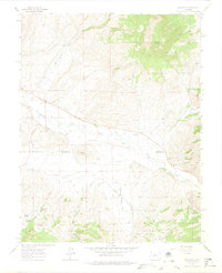
1962 Map of Doyleville
USGS Topo · Published 1974About this map
The Tomichi Dome towers over this Colorado landscape, marking a transition between the northern high ground of the Gunnison National Forest and the fertile valley of Tomichi Creek. In the early 1960s, the small settlement of Doyleville served as a focal point for the local ranching community, evidenced by the nearby Doyleville Sch and Cem. The valley floor is crisscrossed by an extensive water management network, including the Arch Irrigating Ditch, which supports operations like the Pleasant View Ranch and Double Heart Ranch.
Find a feature on this map
33 named features on this map. Tap any name to fly to it.
Don’t see what you’re looking for? This feature index may not catch every label — zoom into the map to look around manually.
Map Details
Editions of this 1962 Doyleville Map
3 editions found
Other maps of this area

1940 · Garfield
USGS Topo · 1:62,500

1941 · Pitkin
USGS Topo · 1:62,500

1945 · Pitkin
USGS Topo · 1:62,500

1945 · Garfield
USGS Topo · 1:62,500

1956 · Montrose
USGS Topo · 1:250,000

1959 · Montrose
USGS Topo · 1:250,000

1960 · Montrose
USGS Topo · 1:250,000

1962 · Doyleville
USGS Topo · 1:24,000

1962 · West Baldy
USGS Topo · 1:24,000

1962 · Houston Gulch
USGS Topo · 1:24,000