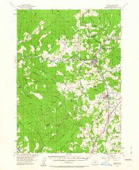
1954 Map of Drain
USGS Topo · Published 1963About this map
The timber and transit corridor of Drain and Yoncalla serves as the focal point of this 1950s-era topographic study. Located along the Southern Pacific railroad and the Pacific Highway, these valley floor settlements are framed by high ridgelines such as Middle Ridge and Renhaven Ridge. The map documents a landscape in transition, where educational infrastructure was shifting away from rural mountain hollows, evidenced by several closed schools including Sunnydale Sch (Aban'd) and Cold Spring Sch (Aban'd).
Find a feature on this map
91 named features on this map. Tap any name to fly to it.
Don’t see what you’re looking for? This feature index may not catch every label — zoom into the map to look around manually.
Map Details
Editions of this 1954 Drain Map
2 editions found
Other maps of this area

1897 · Roseburg
USGS Topo · 1:125,000

1900 · Roseburg
USGS Topo · 1:125,000

1921 · Cottage Grove
USGS Topo · 1:62,500

1928 · Sitkum
USGS Topo · 1:125,000

1942 · Crow
USGS Topo · 1:62,500

1942 · Roman Nose Mtn
USGS Topo · 1:62,500

1945 · Crow
USGS Topo · 1:62,500

1945 · Roman Nose Mtn
USGS Topo · 1:62,500

1954 · Sutherlin
USGS Topo · 1:62,500

1954 · Drain
USGS Topo · 1:62,500