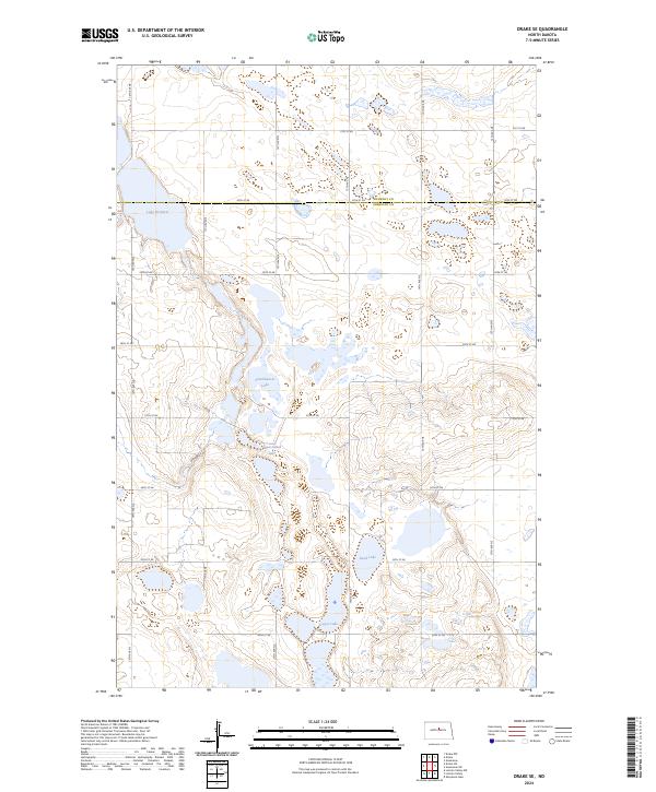
2024 Map of Drake SE
USGS Topo · Published 2024About this map
Sheridan County Waterfowl Production Area dominates the southern half of this landscape, reflecting a region defined by its wetland ecology and glacial prairie potholes. The terrain is marked by numerous water bodies including Lake Richard and Frankhauser Lake, which are linked by a network of rural section-line roads like 12th Ave NE and 30th St NE. The boundary between McHenry Co and Sheridan Co runs east-west across the northern portion of the map, intersecting with the McHenry County Waterfowl Production Area. This 2024 survey captures the persistence of the conservation-focused landscape, where larger bodies like Sand Lake and Moorehead Lake provide essential habitat in the North Dakota interior.
Find a feature on this map
28 named features on this map. Tap any name to fly to it.
Don’t see what you’re looking for? This feature index may not catch every label — zoom into the map to look around manually.
Map Details
Editions of this 2024 Drake SE Map
This is the sole edition of this map. No revisions or reprints were ever made.
Other maps of this area

1930 · Drake
USGS Topo · 1:62,500

1940 · Aylmer
USGS Topo · 1:62,500

1946 · Sheyenne Lake
USGS Topo · 1:48,000

1947 · Lincoln Valley
USGS Topo · 1:62,500

1947 · Sheyenne Lake
USGS Topo · 1:62,500

1950 · Sheyenne Lake
USGS Topo · 1:24,000

1951 · Anamoose SW
USGS Topo · 1:24,000

1954 · McClusky
USGS Topo · 1:250,000

1958 · McClusky
USGS Topo · 1:250,000
1958 · Anamoose
USGS Topo · 1:24,000