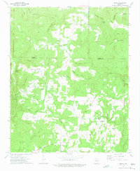
1973 Map of Drasco
USGS Topo · Published 1975About this map
The community of Drasco serves as a primary reference point in this corner of the Ozark foothills during the early 1970s. The landscape is defined by a dense network of hollows and ridges, including the local heights of Fortune Mountain and Sam Johnson Mountain. Genealogical interest is concentrated around rural anchors like Macedonia Cem and the nearby Friendship Ch.
Find a feature on this map
88 named features on this map. Tap any name to fly to it.
Don’t see what you’re looking for? This feature index may not catch every label — zoom into the map to look around manually.
Map Details
Editions of this 1973 Drasco Map
2 editions found
Other maps of this area

1890 · Batesville
USGS Topo · 1:125,000

1891 · Batesville
USGS Topo · 1:125,000

1892 · Mountain View
USGS Topo · 1:125,000

1894 · Mountain View
USGS Topo · 1:125,000

1942 · Bethesda
USGS Topo · 1:24,000

1942 · Almond
USGS Topo · 1:31,680

1953 · Memphis
USGS Topo · 1:250,000

1956 · Memphis
USGS Topo · 1:250,000

1956 · Russellville
USGS Topo · 1:250,000

1964 · Russellville
USGS Topo · 1:250,000