
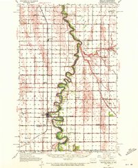
1939 Map of Drayton
USGS Topo · Published 1954About this map
The Red River of the North winds in sharp, serpentine loops along the border between North Dakota and Minnesota, defining the landscape of this 1939 survey. The town of Drayton serves as a primary hub along the Northern Pacific railroad, which runs parallel to the river's western bank through Pittsburg and Bowesmont. This era reveals a densely organized rural society, evidenced by the high concentration of one-room schoolhouses such as Westerson Sch, Lincoln Sch, and Johnson Sch that once served the agricultural community.
Find a feature on this map
46 named features on this map. Tap any name to fly to it.
Don’t see what you’re looking for? This feature index may not catch every label — zoom into the map to look around manually.
Map Details
Editions of this 1939 Drayton Map
2 editions found
Other maps of this area

1918 · Acton
USGS Topo · 1:62,500

1918 · Argyle
USGS Topo · 1:62,500

1939 · Glasston
USGS Topo · 1:62,500

1939 · Pembina
USGS Topo · 1:62,500

1939 · Kennedy
USGS Topo · 1:62,500

1941 · Kennedy
USGS Topo · 1:62,500

1941 · Drayton
USGS Topo · 1:62,500

1941 · Glasston
USGS Topo · 1:62,500

1941 · Hallock
USGS Topo · 1:62,500

1941 · Bathgate
USGS Topo · 1:62,500