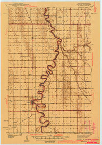
1941 Map of Drayton
USGS Topo · Published 1941About this map
The Red River of the North winds in sharp oxbows through this Red River Valley landscape, creating a natural border between Pembina County, North Dakota, and the Minnesota counties of Kittson and Marshall. Drayton serves as the primary hub, situated where the Northern Pacific railway meets the river's edge. The surrounding agricultural flats are exceptionally dense with small rural institutions, reflecting a period of high rural population before mid-century farm consolidation.
Find a feature on this map
31 named features on this map. Tap any name to fly to it.
Don’t see what you’re looking for? This feature index may not catch every label — zoom into the map to look around manually.
Map Details
Editions of this 1941 Drayton Map
2 editions found
Other maps of this area

1918 · Acton
USGS Topo · 1:62,500

1918 · Argyle
USGS Topo · 1:62,500

1939 · Drayton
USGS Topo · 1:62,500

1939 · Glasston
USGS Topo · 1:62,500

1939 · Pembina
USGS Topo · 1:62,500

1939 · Kennedy
USGS Topo · 1:62,500

1941 · Kennedy
USGS Topo · 1:62,500

1941 · Drayton
USGS Topo · 1:62,500

1941 · Glasston
USGS Topo · 1:62,500

1941 · Hallock
USGS Topo · 1:62,500