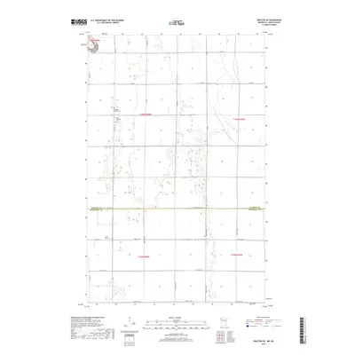
2019 Map of Drayton SE
USGS Topo · Published 2019About this map
The North Dakota and Minnesota border region is defined by a rigid grid of rural roads and the flat, agricultural landscape of the Red River Valley. This 2019 survey captures the quiet corner where Kittson and Marshall counties meet, a region largely partitioned by section lines and townships such as t159n r50w and t158n r50w. Local heritage is preserved in the small, scattered burial grounds that serve the farming community, including Skjeberg Lutheran Cem and Teien Covenant Cem. These sites, along with Eagle Point Cem, remain the primary landmarks in an area dominated by large-scale field patterns and county thoroughfares like Co Rd 7 and Co St Aid Hwy 18. The map illustrates the contemporary infrastructure of the American Midwest, where early pioneer legacy is visible through church-affiliated cemeteries and the enduring township-and-range surveying system.
Find a feature on this map
30 named features on this map. Tap any name to fly to it.
Don’t see what you’re looking for? This feature index may not catch every label — zoom into the map to look around manually.
Map Details
Editions of this 2019 Drayton SE Map
This is the sole edition of this map. No revisions or reprints were ever made.
Other maps of this area

1918 · Acton
USGS Topo · 1:62,500

1918 · Argyle
USGS Topo · 1:62,500

1939 · Drayton
USGS Topo · 1:62,500

1939 · Kennedy
USGS Topo · 1:62,500

1941 · Kennedy
USGS Topo · 1:62,500

1941 · Drayton
USGS Topo · 1:62,500

1952 · Thief River Falls
USGS Topo · 1:250,000

1954 · Stephen
USGS Topo · 1:62,500

1956 · Thief River Falls
USGS Topo · 1:250,000

1957 · Thief River Falls
USGS Topo · 1:250,000