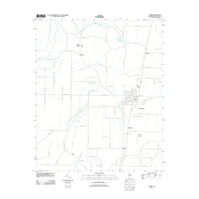
2012 Map of Drew
USGS Topo · Published 2012About this map
Drew serves as the central hub of this Mississippi Delta landscape, characterized by a dense network of drainage canals and bayous that define the agricultural patterns of Sunflower County. The town layout is clearly defined along the rail corridor, while smaller outlying settlements such as Dwiggins, Whitney, and Jaquith mark the intersections of the rural road system. Water management is a dominant theme of the terrain, with Big Sunflower River and Blackhaw Bayou snaking through the flatlands, accompanied by numerous engineered channels like Lutken Bayou and Burrell Bayou. For those tracing local family roots, the map identifies several key burial sites including Sandy Bayou Cem, Drew Cem, and Marshall Cem. The presence of the Ruleville-Drew Airport south of town indicates the modernization of local transport and crop dusting infrastructure in this deeply rooted farming community.
Find a feature on this map
89 named features on this map. Tap any name to fly to it.
Don’t see what you’re looking for? This feature index may not catch every label — zoom into the map to look around manually.
Map Details
Editions of this 2012 Drew Map
This is the sole edition of this map. No revisions or reprints were ever made.
Other maps of this area

1931 · Schlater
USGS Topo · 1:48,000

1931 · Sumner
USGS Topo · 1:48,000

1931 · Drew
USGS Topo · 1:48,000

1934 · Cleveland
USGS Topo · 1:62,500

1934 · Schlater
USGS Topo · 1:62,500

1935 · Sumner
USGS Topo · 1:62,500

1935 · Mound Bayou
USGS Topo · 1:62,500

1939 · Schlater
USGS Topo · 1:62,500

1939 · Sumner
USGS Topo · 1:62,500

1940 · Cleveland
USGS Topo · 1:62,500