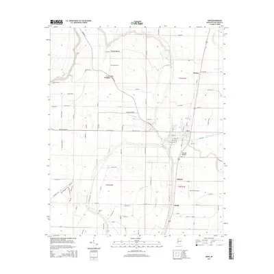
2015 Map of Drew
USGS Topo · Published 2015About this map
Drew serves as the primary hub of this Mississippi Delta landscape, where a dense grid of agricultural roads and bayous defines the local geography. The territory is marked by the meandering paths of Big Sunflower River and several significant drainage systems, including Burrell Bayou and Powell Bayou. These waterways shaped the early development of the region, as evidenced by the distribution of small settlements like Sandy Bayou, Whitney, and Dwiggins.
Find a feature on this map
96 named features on this map. Tap any name to fly to it.
Don’t see what you’re looking for? This feature index may not catch every label — zoom into the map to look around manually.
Map Details
Editions of this 2015 Drew Map
This is the sole edition of this map. No revisions or reprints were ever made.
Other maps of this area

1931 · Schlater
USGS Topo · 1:48,000

1931 · Sumner
USGS Topo · 1:48,000

1931 · Drew
USGS Topo · 1:48,000

1934 · Cleveland
USGS Topo · 1:62,500

1934 · Schlater
USGS Topo · 1:62,500

1935 · Sumner
USGS Topo · 1:62,500

1935 · Mound Bayou
USGS Topo · 1:62,500

1939 · Schlater
USGS Topo · 1:62,500

1939 · Sumner
USGS Topo · 1:62,500

1940 · Cleveland
USGS Topo · 1:62,500