
1955 Map of Driggs
USGS Topo · Published 1967About this map
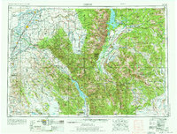
The Snake River and its major tributaries, including the Henry's Fork and Teton River, define the settlement patterns of this 1950s landscape across the Idaho-Wyoming border. Agriculture and small towns dominate the western plains, where the Union Pacific RR connects communities like St Anthony, Rexburg, and Rigby. The eastern half of the sheet transitions sharply into the high country of the Grand Teton National Park and the Gros Ventre Range, anchored by the unmistakable peak of Grand Teton.
Find a feature on this map
85 named features on this map. Tap any name to fly to it.
Don’t see what you’re looking for? This feature index may not catch every label — zoom into the map to look around manually.
Map Details
Editions of this 1955 Driggs Map
3 editions found
Other maps of this area

1885 · Lake
USGS Topo · 1:125,000

1886 · Shoshone
USGS Topo · 1:125,000

1888 · Shoshone
USGS Topo · 1:125,000

1893 · Ishawooa
USGS Topo · 1:125,000

1895 · Shoshone
USGS Topo · 1:125,000

1895 · Ishawooa
USGS Topo · 1:125,000

1895 · Lake
USGS Topo · 1:125,000

1896 · Lake
USGS Topo · 1:125,000

1899 · Ishawooa
USGS Topo · 1:125,000

1899 · Grand Teton
USGS Topo · 1:125,000