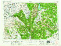
1958 Map of Driggs
USGS Topo · Published 1958About this map
Grand Teton and the high peaks of the Teton Range dominate the eastern landscape of this 1950s survey, marking a dramatic transition from the volcanic plains of the west. To the west, the Snake River and Henry's Fork define a fertile valley supporting established agricultural hubs like St Anthony and Rexburg. The irrigation network of the Teton Basin is clearly visible, feeding settlements such as Driggs, Tetonia, and Victor.
Find a feature on this map
154 named features on this map. Tap any name to fly to it.
Don’t see what you’re looking for? This feature index may not catch every label — zoom into the map to look around manually.
Map Details
Editions of this 1958 Driggs Map
2 editions found

Other maps of this area

1885 · Lake
USGS Topo · 1:125,000

1886 · Shoshone
USGS Topo · 1:125,000

1888 · Shoshone
USGS Topo · 1:125,000

1893 · Ishawooa
USGS Topo · 1:125,000

1895 · Shoshone
USGS Topo · 1:125,000

1895 · Ishawooa
USGS Topo · 1:125,000

1895 · Lake
USGS Topo · 1:125,000

1896 · Lake
USGS Topo · 1:125,000

1899 · Ishawooa
USGS Topo · 1:125,000

1899 · Grand Teton
USGS Topo · 1:125,000