
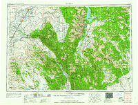
1958 Map of Driggs
USGS Topo · Published 1958About this map
The massive peaks of the Teton Range define this mid-century look at the Idaho-Wyoming borderlands. Agriculture and transport networks are centered in the fertile valleys of the Snake River and its tributaries, where the Union Pacific railroad services established towns like Rexburg, St Anthony, and Sugar City. The map documents a landscape of dramatic transitions, from the geological oddities of the Sand Dunes and Lava fields in the northwest to the protected wilderness of Grand Teton National Park and the National Elk Refuge. High mountain passes like Togwotee Pass and Union Pass provide critical links through the Gros Ventre Range and Wind River Range, while the Palisades Reservoir illustrates the engineering of water resources in the Snake River Range.
Find a feature on this map
124 named features on this map. Tap any name to fly to it.
Don’t see what you’re looking for? This feature index may not catch every label — zoom into the map to look around manually.
Map Details
Editions of this 1958 Driggs Map
2 editions found
Other maps of this area

1885 · Lake
USGS Topo · 1:125,000

1886 · Shoshone
USGS Topo · 1:125,000

1888 · Shoshone
USGS Topo · 1:125,000

1893 · Ishawooa
USGS Topo · 1:125,000

1895 · Shoshone
USGS Topo · 1:125,000

1895 · Ishawooa
USGS Topo · 1:125,000

1895 · Lake
USGS Topo · 1:125,000

1896 · Lake
USGS Topo · 1:125,000

1899 · Ishawooa
USGS Topo · 1:125,000

1899 · Grand Teton
USGS Topo · 1:125,000