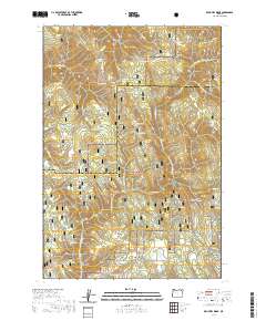
2020 Map of Drumhill Ridge
USGS Topo · Published 2020About this map
Umatilla National Forest and Whitman National Forest converge in this high-altitude landscape of the Blue Mountains, where the boundary between Umatilla and Union counties traverses complex ridges and deep canyons. The map documents an intricate network of timber and recreational access routes, including the Whitman Route and the Evans Ohv trail system, alongside specialized paths like the Mt Emily Snowmobile route. Named landmarks such as Fiddlers Hell and Sugarloaf Mtn rise above a terrain punctuated by vital water sources like Sacajawea Spring and Daniel Spring. The presence of features like Standfield Meadow and Three Cabin Ridge suggests a history of high-country grazing and seasonal habitation, while the drainage of Middle Fork Mount Emily Creek and Five Points Creek defines the local watershed during this modern era of forest management.
Find a feature on this map
70 named features on this map. Tap any name to fly to it.
Don’t see what you’re looking for? This feature index may not catch every label — zoom into the map to look around manually.
Map Details
Editions of this 2020 Drumhill Ridge Map
This is the sole edition of this map. No revisions or reprints were ever made.
Other maps of this area

1953 · Pendleton
USGS Topo · 1:250,000

1956 · Pendleton
USGS Topo · 1:250,000

1963 · La Grande SE
USGS Topo · 1:24,000

1963 · Sanderson Spring
USGS Topo · 1:24,000

1963 · Hilgard
USGS Topo · 1:24,000

1963 · Summerville
USGS Topo · 1:24,000

1964 · Duncan
USGS Topo · 1:24,000

1964 · Thimbleberry Mtn
USGS Topo · 1:24,000

1964 · Huron
USGS Topo · 1:24,000

1964 · Drumhill Ridge
USGS Topo · 1:24,000