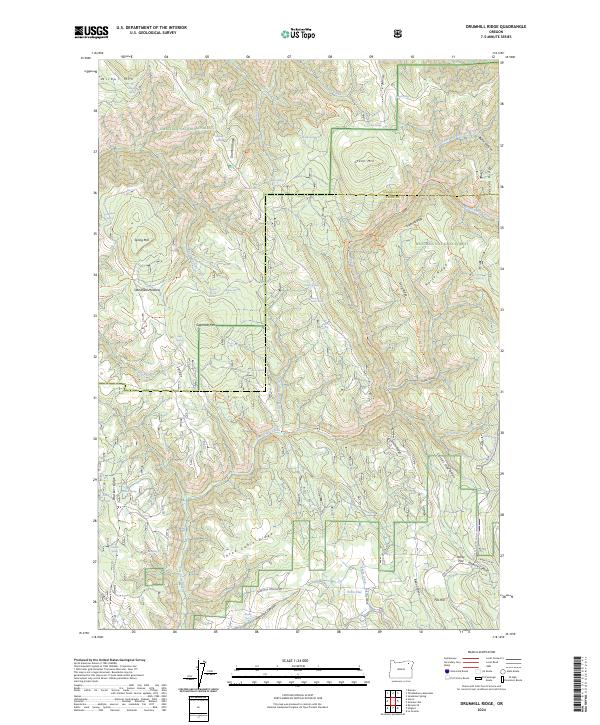
2024 Map of Drumhill Ridge
USGS Topo · Published 2024About this map
Umatilla National Forest and Whitman National Forest meet in this highland region of the Blue Mountains, defined by a complex network of high ridges and deep canyons. The landscape is characterized by prominent elevations such as Wilbur Mtn and Green Mtn, separated by watercourses like Five Points Creek and Bear Creek. The map reveals a history of seasonal mountain life and livestock management through features like Standfield Meadow and numerous isolated water sources including Tie Camp Spring and Sacajawea Spring. Evidence of recreational and forest management access is visible in the trail networks, including the Whitman Route Trl and the Mt Emily Snowmobile Trl. This contemporary survey preserves the traditional nomenclature of the timber and ranching eras, from the descriptive Telephone Ridge to the more colorful Fiddlers Hell.
Find a feature on this map
72 named features on this map. Tap any name to fly to it.
Don’t see what you’re looking for? This feature index may not catch every label — zoom into the map to look around manually.
Map Details
Editions of this 2024 Drumhill Ridge Map
This is the sole edition of this map. No revisions or reprints were ever made.
Other maps of this area

1953 · Pendleton
USGS Topo · 1:250,000

1956 · Pendleton
USGS Topo · 1:250,000

1963 · La Grande SE
USGS Topo · 1:24,000

1963 · Sanderson Spring
USGS Topo · 1:24,000

1963 · Hilgard
USGS Topo · 1:24,000

1963 · Summerville
USGS Topo · 1:24,000

1964 · Duncan
USGS Topo · 1:24,000

1964 · Thimbleberry Mtn
USGS Topo · 1:24,000

1964 · Huron
USGS Topo · 1:24,000

1964 · Drumhill Ridge
USGS Topo · 1:24,000