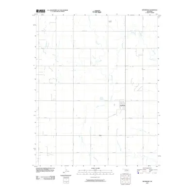
2009 Map of Drummond
USGS Topo · Published 2009About this map
Drummond serves as the primary hub of this Garfield County landscape, situated amid a grid of rural roads and seasonal watercourses. The town's layout and surrounding section lines reflect the late 20th-century agricultural character of the region. Family and community heritage is well-preserved through several burial grounds, including Sunnyside Cemetery in the north and Imo Cemetery to the east. The drainage pattern is defined by the winding paths of Turkey Creek and Dry Salt Creek, which intersect the steady geometry of the county road system. Tracing the routes of W Fox DR and d0498 RD reveals the connection between isolated farmsteads and the central settlement. This survey provides a clear view of the area's geography before significant 21st-century changes, capturing the placement of Delnorte Cemetery and the various branches of Elm Creek and Clear Creek that feed the local watershed.
Find a feature on this map
24 named features on this map. Tap any name to fly to it.
Don’t see what you’re looking for? This feature index may not catch every label — zoom into the map to look around manually.
Map Details
Editions of this 2009 Drummond Map
This is the sole edition of this map. No revisions or reprints were ever made.
Other maps of this area

1893 · Hennessey
USGS Topo · 1:62,500

1893 · Ames
USGS Topo · 1:62,500

1955 · Enid West
USGS Topo · 1:24,000

1955 · Enid
USGS Topo · 1:250,000

1955 · Woodward
USGS Topo · 1:250,000

1956 · Ames
USGS Topo · 1:62,500

1956 · Hennessey
USGS Topo · 1:62,500

1956 · Enid
USGS Topo · 1:62,500

1956 · Ringwood
USGS Topo · 1:62,500

1958 · Enid
USGS Topo · 1:250,000