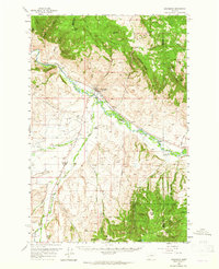
1958 Map of Drummond
USGS Topo · Published 1965About this map
Clark Fork valley life in the late 1950s is defined by the dual presence of the Northern Pacific and the Chicago Milwaukee St Paul and Pacific railroads. These lines parallel the river through the heart of Drummond, serving as the primary transit corridor between the Garnet Range to the north and the southern highlands of Deerlodge National Forest. Agricultural patterns are evident along the Allendale Ditch and the winding course of Flint Creek, where small settlements like New Chicago and Hall anchor the rural landscape. The map captures a moment of transition where legacy infrastructure, such as the Valley Cem, exists alongside mid-century developments like the Drummond Airport and a prominent Pipeline. To the south, the terrain rises sharply toward Dunkleberg Ridge, marking the limit of the valley's settlement at Sherryl and Stone.
Find a feature on this map
48 named features on this map. Tap any name to fly to it.
Don’t see what you’re looking for? This feature index may not catch every label — zoom into the map to look around manually.
Map Details
Editions of this 1958 Drummond Map
3 editions found
Other maps of this area

1889 · Helena
USGS Topo · 1:250,000

1893 · Helena
USGS Topo · 1:250,000

1899 · Helena
USGS Topo · 1:250,000

1903 · Helena
USGS Topo · 1:250,000

1908 · Philipsburg
USGS Topo · 1:125,000

1919 · Drummond
USGS Topo · 1:125,000

1921 · Drummond
USGS Topo · 1:125,000

1947 · Butte
USGS Topo · 1:250,000

1958 · Butte
USGS Topo · 1:250,000

1958 · Drummond
USGS Topo · 1:62,500