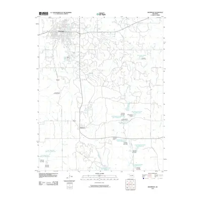
2010 Map of Drumright
USGS Topo · Published 2010About this map
Drumright anchors the northern edge of this Creek County landscape, showing a dense residential grid that transitions south into a region defined by complex water management and rural homesteads. The terrain is marked by the extensive Little Deep Fork Creek watershed, featuring a series of flood control structures and reservoirs including Little Deep Fork Creek Site 10 Reservoir and Little Deep Fork Creek Site 13 Reservoir. These engineering works, along with others like Tydol Lake, illustrate the historical efforts to manage the tributaries of the Deep Fork River in this part of Oklahoma.
Find a feature on this map
58 named features on this map. Tap any name to fly to it.
Don’t see what you’re looking for? This feature index may not catch every label — zoom into the map to look around manually.
Map Details
Editions of this 2010 Drumright Map
This is the sole edition of this map. No revisions or reprints were ever made.
Other maps of this area

1901 · Nuyaka
USGS Topo · 1:125,000

1912 · Hominy
USGS Topo · 1:125,000

1915 · Hominy
USGS Topo · 1:125,000

1916 · Bristow
USGS Topo · 1:62,500

1929 · Yale
USGS Topo · 1:62,500

1931 · Drumright
USGS Topo · 1:62,500

1932 · Yale
USGS Topo · 1:62,500

1954 · Oklahoma City
USGS Topo · 1:250,000

1955 · Enid
USGS Topo · 1:250,000

1957 · Oklahoma City
USGS Topo · 1:250,000