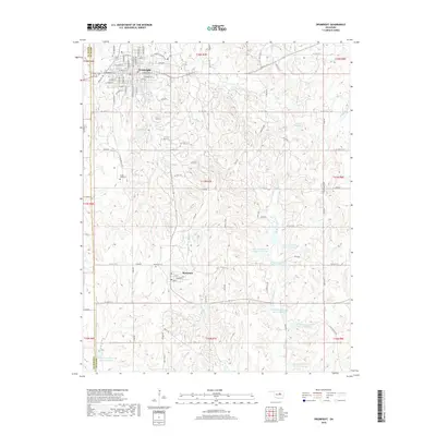
2018 Map of Drumright
USGS Topo · Published 2018About this map
Drumright dominates the northern portion of this Creek County landscape, featuring a dense network of residential streets such as W Hickory St and W Noble St. The town's layout and surrounding road network suggest its long-standing role as a local hub, connected to the southern settlement of Shamrock via the Old Shamrock Hwy and Tipperary Rd. This 2018 survey reveals a terrain defined by a significant water management system, characterized by a series of flood control structures including Little Deep Fork Cr Site 12 Reservoir and several numbered sites along the Little Deep Fork Cr Site 14 Reservoir. Genealogists will find the South Side Cem and Shamrock Cem clearly marked, providing precise locations for family history research. The geography is further articulated by the meeting of several township and range lines, and the winding paths of Tiger Cr and Catfish Cr.
Find a feature on this map
95 named features on this map. Tap any name to fly to it.
Don’t see what you’re looking for? This feature index may not catch every label — zoom into the map to look around manually.
Map Details
Editions of this 2018 Drumright Map
This is the sole edition of this map. No revisions or reprints were ever made.
Other maps of this area

1901 · Nuyaka
USGS Topo · 1:125,000

1912 · Hominy
USGS Topo · 1:125,000

1915 · Hominy
USGS Topo · 1:125,000

1916 · Bristow
USGS Topo · 1:62,500

1929 · Yale
USGS Topo · 1:62,500

1931 · Drumright
USGS Topo · 1:62,500

1932 · Yale
USGS Topo · 1:62,500

1954 · Oklahoma City
USGS Topo · 1:250,000

1955 · Enid
USGS Topo · 1:250,000

1957 · Oklahoma City
USGS Topo · 1:250,000