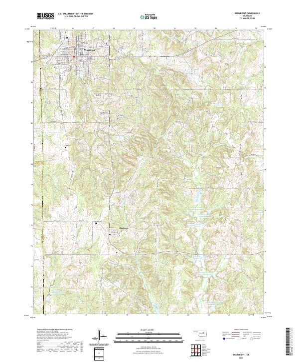
2022 Map of Drumright
USGS Topo · Published 2022About this map
The city of Drumright serves as a primary hub in this Oklahoma landscape, situated at the intersection of Creek, Payne, and Lincoln counties. The town's grid is well-defined by streets such as Denver Jackson Blvd and W Broadway St, reflecting its established position in the region. Further south, the smaller settlement of Shamrock sits along the Old Shamrock Hwy, offering a closer look at the local geography including Tipperary Rd and the Shamrock Cem.
Find a feature on this map
65 named features on this map. Tap any name to fly to it.
Don’t see what you’re looking for? This feature index may not catch every label — zoom into the map to look around manually.
Map Details
Editions of this 2022 Drumright Map
This is the sole edition of this map. No revisions or reprints were ever made.
Other maps of this area

1901 · Nuyaka
USGS Topo · 1:125,000

1912 · Hominy
USGS Topo · 1:125,000

1915 · Hominy
USGS Topo · 1:125,000

1916 · Bristow
USGS Topo · 1:62,500

1929 · Yale
USGS Topo · 1:62,500

1931 · Drumright
USGS Topo · 1:62,500

1932 · Yale
USGS Topo · 1:62,500

1954 · Oklahoma City
USGS Topo · 1:250,000

1955 · Enid
USGS Topo · 1:250,000

1957 · Oklahoma City
USGS Topo · 1:250,000