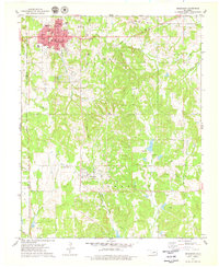
1975 Map of Drumright
USGS Topo · Published 1979About this map
The Shannon Oil Field and Tiger Field dominate the landscape around Drumright, reflecting the region's mid-century industrial identity. This mid-1970s survey illustrates a community well-established with civic infrastructure, including the Central Technical Sch, Edison Sch, and Hospital. The urban grid of Drumright is clearly defined, while to the south, the smaller settlement of Shamrock sits near the Shamrock Cem.
Find a feature on this map
35 named features on this map. Tap any name to fly to it.
Don’t see what you’re looking for? This feature index may not catch every label — zoom into the map to look around manually.
Map Details
Editions of this 1975 Drumright Map
This is the sole edition of this map. No revisions or reprints were ever made.
Other maps of this area

1901 · Nuyaka
USGS Topo · 1:125,000

1912 · Hominy
USGS Topo · 1:125,000

1915 · Hominy
USGS Topo · 1:125,000

1916 · Bristow
USGS Topo · 1:62,500

1929 · Yale
USGS Topo · 1:62,500

1931 · Drumright
USGS Topo · 1:62,500

1932 · Yale
USGS Topo · 1:62,500

1954 · Oklahoma City
USGS Topo · 1:250,000

1955 · Enid
USGS Topo · 1:250,000

1957 · Oklahoma City
USGS Topo · 1:250,000