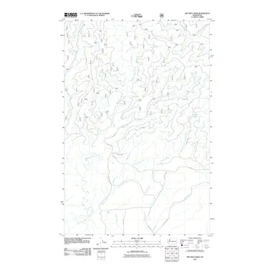
2011 Map of Dry Bed Lakes
USGS Topo · Published 2011About this map
The Middle Fork Satsop River and its intricate drainage network define this 2011 survey of the Olympic Peninsula foothills. This landscape is characterized by a dense system of tributary streams, including Baker Creek, Dry Bed Creek, and Rabbit Creek, which flow through steep topography managed as forest land. The ephemeral nature of the local hydrology is evident in the naming of the Dry Bed Lakes, situated in the eastern portion of the quadrangle.
Find a feature on this map
23 named features on this map. Tap any name to fly to it.
Don’t see what you’re looking for? This feature index may not catch every label — zoom into the map to look around manually.
Map Details
Editions of this 2011 Dry Bed Lakes Map
This is the sole edition of this map. No revisions or reprints were ever made.
Other maps of this area

1921 · Satsop
USGS Topo · 1:62,500

1941 · Mobray
USGS Topo · 1:62,500

1943 · Nahwatzel Lake
USGS Topo · 1:62,500

1943 · Mobray
USGS Topo · 1:62,500

1953 · Mt Tebo
USGS Topo · 1:62,500

1953 · Elma
USGS Topo · 1:62,500

1955 · Wynoochee Valley
USGS Topo · 1:62,500

1955 · Grisdale
USGS Topo · 1:62,500

1958 · Seattle
USGS Topo · 1:250,000

1962 · Seattle
USGS Topo · 1:250,000