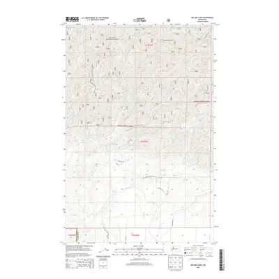
2014 Map of Dry Bed Lakes
USGS Topo · Published 2014About this map
The Olympic National Forest dominates this landscape in the southern foothills of the Olympic Mountains, where the boundary between Grays Harbor and Mason counties divides a network of timber access roads and mountain drainages. The topography is defined by the Middle Fork Satsop River and the Canyon River, which carve deep valleys through the terrain. A complex system of forest development routes, such as Natl Forest Develop Road 2341 and Nat For Dev Rd 2199, provides access to the higher elevations and the eponymous Dry Bed Lakes. Further south, the terrain levels out toward the headwaters of Dry Bed Cr and Decker Cr, where local thoroughfares like Beeville Rd and Kelly Hall Rd suggest the transition from strictly managed forest land to more accessible rural tracts.
Find a feature on this map
34 named features on this map. Tap any name to fly to it.
Don’t see what you’re looking for? This feature index may not catch every label — zoom into the map to look around manually.
Map Details
Editions of this 2014 Dry Bed Lakes Map
This is the sole edition of this map. No revisions or reprints were ever made.
Other maps of this area

1921 · Satsop
USGS Topo · 1:62,500

1941 · Mobray
USGS Topo · 1:62,500

1943 · Nahwatzel Lake
USGS Topo · 1:62,500

1943 · Mobray
USGS Topo · 1:62,500

1953 · Mt Tebo
USGS Topo · 1:62,500

1953 · Elma
USGS Topo · 1:62,500

1955 · Wynoochee Valley
USGS Topo · 1:62,500

1955 · Grisdale
USGS Topo · 1:62,500

1958 · Seattle
USGS Topo · 1:250,000

1962 · Seattle
USGS Topo · 1:250,000