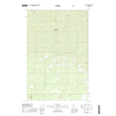
2020 Map of Dry Bed Lakes
USGS Topo · Published 2020About this map
The Olympic National Forest dominates the high-elevation terrain of the Olympic Mountains in this recent survey of the boundary between Grays Harbor and Mason counties. A dense network of drainage systems defines the landscape, most notably the Middle Fork Satsop River and the Canyon River. The namesake Dry Bed Lakes sit in the eastern portion of the quadrangle, surrounded by the headwaters of Vance Cr and Baker Cr.
Find a feature on this map
44 named features on this map. Tap any name to fly to it.
Don’t see what you’re looking for? This feature index may not catch every label — zoom into the map to look around manually.
Map Details
Editions of this 2020 Dry Bed Lakes Map
This is the sole edition of this map. No revisions or reprints were ever made.
Other maps of this area

1921 · Satsop
USGS Topo · 1:62,500

1941 · Mobray
USGS Topo · 1:62,500

1943 · Nahwatzel Lake
USGS Topo · 1:62,500

1943 · Mobray
USGS Topo · 1:62,500

1953 · Mt Tebo
USGS Topo · 1:62,500

1953 · Elma
USGS Topo · 1:62,500

1955 · Wynoochee Valley
USGS Topo · 1:62,500

1955 · Grisdale
USGS Topo · 1:62,500

1958 · Seattle
USGS Topo · 1:250,000

1962 · Seattle
USGS Topo · 1:250,000