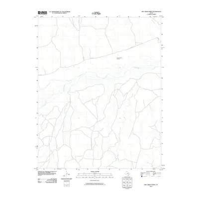
2010 Map of Dry Creek North
USGS Topo · Published 2010About this map
The Canadian River carves a central path through this section of Roberts County, shaping a landscape defined by seasonal drainages and ranch access. In the northern reaches, Government Canyon provides a distinct break in the topography near N River Rd. The area is characterized by several significant tributaries that feed toward the river valley, including Tallahone Creek and Pats Creek to the west, and Dry Creek to the east. Human presence is marked primarily by rural infrastructure such as Reynolds Ranch Rd and Wilson Rd, which navigate the terrain between the river and the northern draws of Jacks Creek. The map documents a sparsely populated ranching environment where the movement of water and the placement of cattle roads dictate the local geography.
Find a feature on this map
9 named features on this map. Tap any name to fly to it.
Don’t see what you’re looking for? This feature index may not catch every label — zoom into the map to look around manually.
Map Details
Editions of this 2010 Dry Creek North Map
This is the sole edition of this map. No revisions or reprints were ever made.
Other maps of this area

1954 · Perryton
USGS Topo · 1:250,000

1954 · Amarillo
USGS Topo · 1:250,000

1958 · Perryton
USGS Topo · 1:250,000

1958 · Amarillo
USGS Topo · 1:250,000

1971 · Dry Creek South
USGS Topo · 1:24,000

1971 · Dry Creek SE
USGS Topo · 1:24,000

1971 · Dry Creek NE
USGS Topo · 1:24,000

1971 · Dry Creek North
USGS Topo · 1:24,000

1971 · Garden Springs
USGS Topo · 1:24,000

1971 · Adobe Creek SE
USGS Topo · 1:24,000