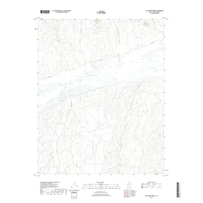
2019 Map of Dry Creek North
USGS Topo · Published 2019About this map
Canadian River dominates this portion of Roberts County, where the wide riverbed creates a complex network of wetlands and seasonal channels. The geography is defined by the significant drainage systems of Tallahone Creek and Dry Creek that converge toward the river valley. To the north, Government Canyon carves into the high plains, illustrating the erosion patterns typical of the Texas Panhandle's broken terrain. Ranching infrastructure is visible through the primitive road network, including Reynolds Ranch Rd and Wilson Rd, which provide access across the ridges. A notable water source, Whitsell Springs, is located near the head of a drainage north of the river, marking a critical point of interest in this arid landscape. The map captures the interface between the broad, sandy river bottoms and the dissected uplands of the Jacks Creek area.
Find a feature on this map
12 named features on this map. Tap any name to fly to it.
Don’t see what you’re looking for? This feature index may not catch every label — zoom into the map to look around manually.
Map Details
Editions of this 2019 Dry Creek North Map
This is the sole edition of this map. No revisions or reprints were ever made.
Other maps of this area

1954 · Perryton
USGS Topo · 1:250,000

1954 · Amarillo
USGS Topo · 1:250,000

1958 · Perryton
USGS Topo · 1:250,000

1958 · Amarillo
USGS Topo · 1:250,000

1971 · Dry Creek South
USGS Topo · 1:24,000

1971 · Dry Creek SE
USGS Topo · 1:24,000

1971 · Dry Creek NE
USGS Topo · 1:24,000

1971 · Dry Creek North
USGS Topo · 1:24,000

1971 · Garden Springs
USGS Topo · 1:24,000

1971 · Adobe Creek SE
USGS Topo · 1:24,000