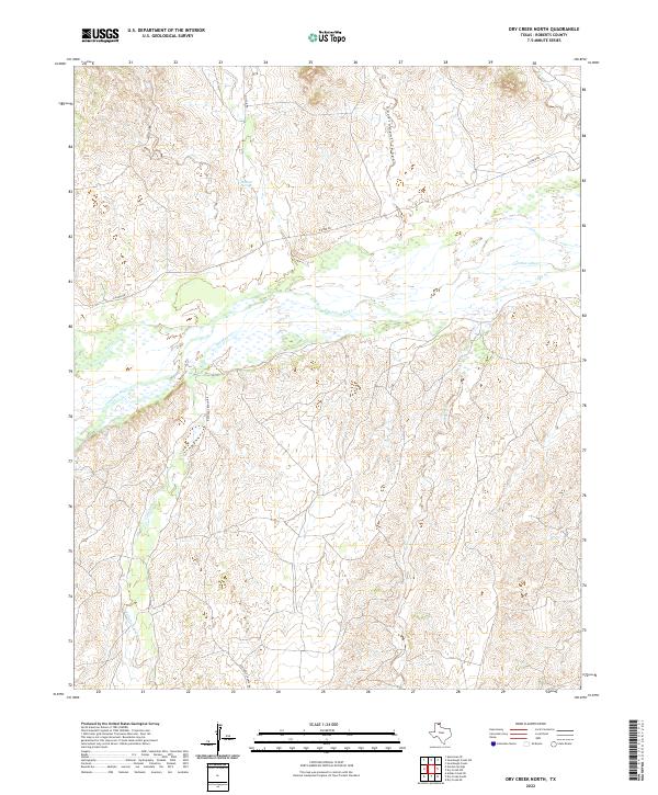
2022 Map of Dry Creek North
USGS Topo · Published 2022About this map
The wide, braided channel of the Canadian River dominates this portion of Roberts County, where the high plains break into a network of canyons and intermittent watercourses. In this ranching landscape, the hydrology of the Texas Panhandle is clearly visible as Tallahone Creek, Pats Cr, and Dry Creek drain toward the river floor. A notable water source, Whitsell Springs, is located in the northern uplands, highlighting the importance of reliable water in this semi-arid environment.
Find a feature on this map
12 named features on this map. Tap any name to fly to it.
Don’t see what you’re looking for? This feature index may not catch every label — zoom into the map to look around manually.
Map Details
Editions of this 2022 Dry Creek North Map
This is the sole edition of this map. No revisions or reprints were ever made.
Other maps of this area

1954 · Perryton
USGS Topo · 1:250,000

1954 · Amarillo
USGS Topo · 1:250,000

1958 · Perryton
USGS Topo · 1:250,000

1958 · Amarillo
USGS Topo · 1:250,000

1971 · Dry Creek South
USGS Topo · 1:24,000

1971 · Dry Creek SE
USGS Topo · 1:24,000

1971 · Dry Creek NE
USGS Topo · 1:24,000

1971 · Dry Creek North
USGS Topo · 1:24,000

1971 · Garden Springs
USGS Topo · 1:24,000

1971 · Adobe Creek SE
USGS Topo · 1:24,000