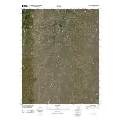
2010 Map of Dry Creek SE
USGS Topo · Published 2010About this map
Indian Creek and Chicken Creek define the drainage patterns across this Roberts County landscape, carving through the terrain in the Texas Panhandle. The map captures a largely rural expanse of ranchland in the early 21st century, where transportation is centered on FM 283 and a network of named ranch roads. In the southeastern corner, the presence of the Willis N Clark Airport suggests a specialized aviation footprint amidst the open country. This area is characterized by its sparse development, with private routes like Payne Ranch Rd and Clark Rd providing access to remote homesteads or industrial sites. The topography is marked by the branching tributaries of the creeks, illustrating the complex erosion patterns common to this part of the High Plains.
Find a feature on this map
6 named features on this map. Tap any name to fly to it.
Don’t see what you’re looking for? This feature index may not catch every label — zoom into the map to look around manually.
Map Details
Editions of this 2010 Dry Creek SE Map
This is the sole edition of this map. No revisions or reprints were ever made.
Other maps of this area

1954 · Amarillo
USGS Topo · 1:250,000

1958 · Amarillo
USGS Topo · 1:250,000

1971 · Dry Creek South
USGS Topo · 1:24,000

1971 · Dry Creek SE
USGS Topo · 1:24,000

1971 · Dry Creek NE
USGS Topo · 1:24,000

1971 · Dry Creek North
USGS Topo · 1:24,000

1971 · Pampa NW
USGS Topo · 1:24,000

1972 · Horse Creek North
USGS Topo · 1:24,000

1972 · Pampa NE
USGS Topo · 1:24,000

1972 · Miami
USGS Topo · 1:24,000