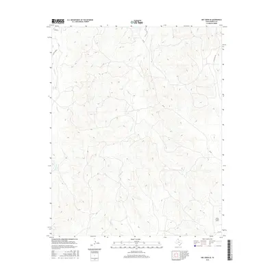
2016 Map of Dry Creek SE
USGS Topo · Published 2016About this map
Indian Cr and Chicken Cr carve a network of drainage patterns across this portion of Roberts County, reflecting the characteristic geography of the Texas Panhandle. The landscape is defined primarily by large ranching operations and isolated rural infrastructure, with Payne Ranch Rd and Ledrick Hqdr Rd providing essential access to remote headquarters and livestock areas. In the southeastern corner, the Willis N Clark Airport serves as a lone aviation landmark amidst the winding contours of the creek breaks. The map captures a moment in the mid-2010s where the road network, including FM 283 and Ledrick Rd, remains sparse, highlighting the enduring isolation and specialized land use of this high plains region.
Find a feature on this map
8 named features on this map. Tap any name to fly to it.
Don’t see what you’re looking for? This feature index may not catch every label — zoom into the map to look around manually.
Map Details
Editions of this 2016 Dry Creek SE Map
This is the sole edition of this map. No revisions or reprints were ever made.
Other maps of this area

1954 · Amarillo
USGS Topo · 1:250,000

1958 · Amarillo
USGS Topo · 1:250,000

1971 · Dry Creek South
USGS Topo · 1:24,000

1971 · Dry Creek SE
USGS Topo · 1:24,000

1971 · Dry Creek NE
USGS Topo · 1:24,000

1971 · Dry Creek North
USGS Topo · 1:24,000

1971 · Pampa NW
USGS Topo · 1:24,000

1972 · Horse Creek North
USGS Topo · 1:24,000

1972 · Pampa NE
USGS Topo · 1:24,000

1972 · Miami
USGS Topo · 1:24,000