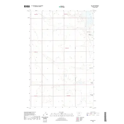
2020 Map of Dry Lake
USGS Topo · Published 2020About this map
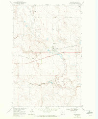
The Milk River carves through the northeastern corner of this Hill County landscape, a region defined by its distinct drainage systems known as coulees. These deep, dry channels, including Archie Coulee and Chain of Lakes Coulee, illustrate the erosional patterns of the northern Montana plains. The presence of Dry Lake and the nearby Dry Lake Coulee suggest a seasonally variable hydrology typical of this high-prairie environment, where water often collects in shallow basins and alkaline flats like Alkali Lakes Coulee. Rural connectivity is established by the grid-aligned section roads and the notable Kremlin High Grade Rd, reflecting the large-scale agricultural and ranching layout of the territory. The map provides a precise look at the township and range divisions, such as t34n r12e, which govern the spatial organization of these expansive Montana rangelands.
Find a feature on this map
16 named features on this map. Tap any name to fly to it.
Don’t see what you’re looking for? This feature index may not catch every label — zoom into the map to look around manually.
Map Details
Editions of this 2020 Dry Lake Map
This is the sole edition of this map. No revisions or reprints were ever made.
Other maps of this area

1906 · Kremlin
USGS Topo · 1:62,500

1920 · Gildford
USGS Topo · 1:125,000

1943 · Gildford
USGS Topo · 1:125,000

1954 · Shelby
USGS Topo · 1:250,000

1958 · Shelby
USGS Topo · 1:250,000
1969 · Sage Lake
USGS Topo · 1:24,000

1969 · Gildford NE
USGS Topo · 1:24,000
1969 · Kremlin
USGS Topo · 1:24,000
1969 · Saddle Butte
USGS Topo · 1:24,000
1969 · Gildford
USGS Topo · 1:24,000