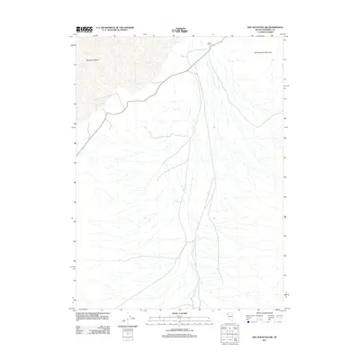
2011 Map of Dry Mountain NW
USGS Topo · Published 2011About this map
Black Rock Desert defines the northern reaches of this high-desert landscape in Pershing County, where the transition from flat playa to rugged uplands is clearly marked. The map illustrates a remote terrain where the sparse infrastructure of the early 21st century is centered on the Garett Ranch in the northeast corner. This ranch serves as a rare point of human habitation in a vast expanse of alluvial fans and ephemeral drainages. Rising to the east, the slopes of Old Razorback Mountain dominate the skyline, while a network of unpaved roads and 4WD tracks provides the only access through the basin, reflecting the persistent isolation of this corner of the Great Basin.
Find a feature on this map
3 named features on this map. Tap any name to fly to it.
Don’t see what you’re looking for? This feature index may not catch every label — zoom into the map to look around manually.
Map Details
Editions of this 2011 Dry Mountain NW Map
This is the sole edition of this map. No revisions or reprints were ever made.
Other maps of this area

1886 · Granite Range
USGS Topo · 1:250,000

1894 · Granite Range
USGS Topo · 1:250,000

1955 · Lovelock
USGS Topo · 1:250,000

1959 · Lovelock
USGS Topo · 1:250,000

1964 · Gerlach
USGS Topo · 1:62,500

1980 · Dry Mountain NW
USGS Topo · 1:24,000

1980 · Eagle Rock Spring
USGS Topo · 1:24,000
1980 · Trego Hot Spring
USGS Topo · 1:24,000

1980 · Dry Mountain
USGS Topo · 1:24,000

1980 · Tenmile
USGS Topo · 1:24,000