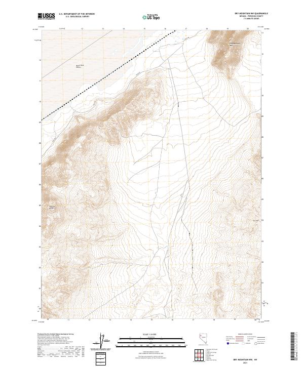
2021 Map of Dry Mountain NW
USGS Topo · Published 2021About this map
The Black Rock Desert dominates the northwestern reaches of this Pershing County landscape, where the flat expanse of the playa meets the rising slopes of the Selenite Range. This 2021 survey illustrates the stark transition from the desert floor to the prominent peaks of Old Razorback Mtn and Dry Mtn. The lone primary artery, Jungo Rd, cuts through the basin, following a path that has long served as a vital connector across this interior drainage basin. The topographic detail highlights the complex drainage patterns and elevation changes across the region's various townships, including t33n r24e, which straddles the edge of the desert and the mountain foothills.
Find a feature on this map
9 named features on this map. Tap any name to fly to it.
Don’t see what you’re looking for? This feature index may not catch every label — zoom into the map to look around manually.
Map Details
Editions of this 2021 Dry Mountain NW Map
This is the sole edition of this map. No revisions or reprints were ever made.
Other maps of this area

1886 · Granite Range
USGS Topo · 1:250,000

1894 · Granite Range
USGS Topo · 1:250,000

1955 · Lovelock
USGS Topo · 1:250,000

1959 · Lovelock
USGS Topo · 1:250,000

1964 · Gerlach
USGS Topo · 1:62,500

1980 · Dry Mountain NW
USGS Topo · 1:24,000

1980 · Eagle Rock Spring
USGS Topo · 1:24,000
1980 · Trego Hot Spring
USGS Topo · 1:24,000

1980 · Dry Mountain
USGS Topo · 1:24,000

1980 · Tenmile
USGS Topo · 1:24,000