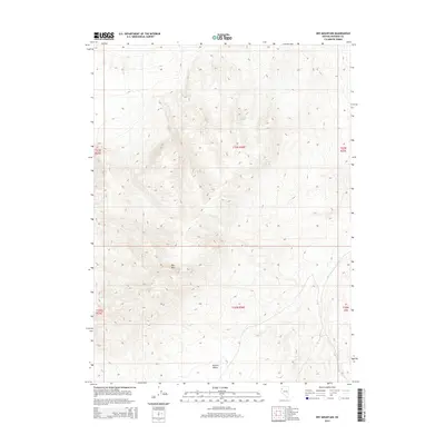
2014 Map of Dry Mountain
USGS Topo · Published 2014About this map
Kumiva Valley dominates the southern reaches of this Pershing County landscape, where the terrain rises sharply toward the prominent summit of Dry Mtn. This 2014 survey by the U.S. Geological Survey documents a high-desert environment defined by its scarce water sources and dramatic elevation changes. Critical reliable water points are few and far between, marked by the presence of Garrett Spring in the northern hills and the seasonally dependent Wet Weather Spring further south. The drainage patterns of the area are characterized by features like Lava Beds Cr, which cuts through the eastern sections of the quadrangle. The map also clearly delineates the township and range boundaries, including t33n r26e and t32n r26e, providing a precise grid for land ownership and boundary research in this part of Nevada.
Find a feature on this map
11 named features on this map. Tap any name to fly to it.
Don’t see what you’re looking for? This feature index may not catch every label — zoom into the map to look around manually.
Map Details
Editions of this 2014 Dry Mountain Map
This is the sole edition of this map. No revisions or reprints were ever made.
Other maps of this area

1886 · Granite Range
USGS Topo · 1:250,000

1894 · Granite Range
USGS Topo · 1:250,000

1931 · Lovelock
USGS Topo · 1:250,000

1935 · Lovelock
USGS Topo · 1:250,000

1955 · Lovelock
USGS Topo · 1:250,000

1959 · Lovelock
USGS Topo · 1:250,000

1980 · Dry Mountain NW
USGS Topo · 1:24,000

1980 · Eagle Rock Spring
USGS Topo · 1:24,000
1980 · Trego Hot Spring
USGS Topo · 1:24,000

1980 · Dry Mountain
USGS Topo · 1:24,000