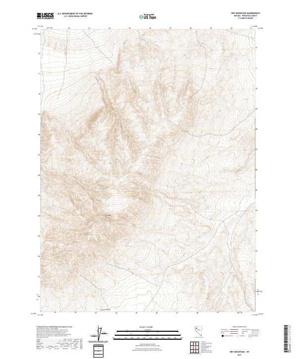
2021 Map of Dry Mountain
USGS Topo · Published 2021About this map
Dry Mountain dominates this portion of Pershing County, surrounded by a complex system of drainage and seasonal water sources. The landscape is defined by its arid character, with ephemeral features such as Wet Weather Spring and Garrett Spring providing the only named water sources in the high ground. To the south, the terrain descends into the Kumiva Valley, illustrating the classic basin-and-range geography of Nevada. The eastern edge of the quadrangle is marked by Lava Beds Creek, which traces the lower elevations near the township boundaries. This 2021 update, published by the U.S. Geological Survey, meticulously maps the township and range lines across the desolate interior, providing a clear view of the public land survey system from T32N to T33N.
Find a feature on this map
11 named features on this map. Tap any name to fly to it.
Don’t see what you’re looking for? This feature index may not catch every label — zoom into the map to look around manually.
Map Details
Editions of this 2021 Dry Mountain Map
This is the sole edition of this map. No revisions or reprints were ever made.
Other maps of this area

1886 · Granite Range
USGS Topo · 1:250,000

1894 · Granite Range
USGS Topo · 1:250,000

1931 · Lovelock
USGS Topo · 1:250,000

1935 · Lovelock
USGS Topo · 1:250,000

1955 · Lovelock
USGS Topo · 1:250,000

1959 · Lovelock
USGS Topo · 1:250,000

1980 · Dry Mountain NW
USGS Topo · 1:24,000

1980 · Eagle Rock Spring
USGS Topo · 1:24,000
1980 · Trego Hot Spring
USGS Topo · 1:24,000

1980 · Dry Mountain
USGS Topo · 1:24,000