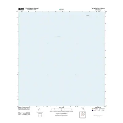
2012 Map of Dry Tortugas OE S
USGS Topo · Published 2012About this map
The Dry Tortugas island group occupies a remote position in the Gulf of Mexico, represented here in the early 21st century. This map focuses on the submerged and partially exposed features of the southwestern reach of the archipelago, where the shallow waters of Bird Key Bank meet the deeper sea. Navigational landmarks such as Bird Key Harbor are critical features in this maritime landscape, which lacks the dense human infrastructure found on the mainland. The sparse labeling reflects the protected and primitive nature of the terrain, providing a clear record of the shifting shoals and banks that define this isolated Florida keys environment.
Find a feature on this map
4 named features on this map. Tap any name to fly to it.
Don’t see what you’re looking for? This feature index may not catch every label — zoom into the map to look around manually.
Map Details
Editions of this 2012 Dry Tortugas OE S Map
This is the sole edition of this map. No revisions or reprints were ever made.
Other maps of this area
1971 · Dry Tortugas
USGS Topo · 1:24,000

1983 · Dry Tortugas
USGS Topo · 1:100,000

1989 · Dry Tortugas
USGS Topo · 1:250,000
2012 · Dry Tortugas
USGS Topo · 1:24,000
2012 · Dry Tortugas OE E
USGS Topo · 1:24,000
2012 · Dry Tortugas OE SE
USGS Topo · 1:24,000
2015 · Dry Tortugas OE SE
USGS Topo · 1:24,000
2015 · Dry Tortugas OE E
USGS Topo · 1:24,000
2015 · Dry Tortugas OE S
USGS Topo · 1:24,000

2015 · Dry Tortugas
USGS Topo · 1:24,000