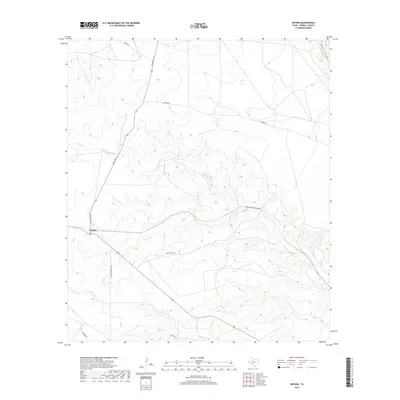
2019 Map of Dryden
USGS Topo · Published 2019About this map
Dryden stands as a focal point in this high-desert landscape of Terrell County, marked by its small cluster of infrastructure and a local Po. The terrain is defined by deep drainage systems, most notably the winding paths of Thurston Canyon and Meyers Canyon which carve through the limestone plateaus. This 2019 survey illustrates a ranching economy dependent on an extensive network of named local tracks such as Vain Cleave Rd and Shafter Crossing Rd, providing access to the isolated draws of Buck Cr and Magoy Cr. The convergence of Ranch Rd 1217 and the primary east-west highway at this location highlights the settlement's role as a critical junction in a region where water sources and reliable roads are the primary drivers of land use.
Find a feature on this map
13 named features on this map. Tap any name to fly to it.
Don’t see what you’re looking for? This feature index may not catch every label — zoom into the map to look around manually.
Map Details
Editions of this 2019 Dryden Map
This is the sole edition of this map. No revisions or reprints were ever made.
Other maps of this area

1918 · Dryden Crossing
USGS Topo · 1:62,500

1928 · Sanderson
USGS Topo · 1:125,000

1943 · Malvado
USGS Topo · 1:62,500

1944 · Malvado
USGS Topo · 1:62,500

1954 · Fort Stockton
USGS Topo · 1:250,000

1954 · Sonora
USGS Topo · 1:250,000

1958 · Sonora
USGS Topo · 1:250,000

1958 · Fort Stockton
USGS Topo · 1:250,000

1958 · Del Rio
USGS Topo · 1:250,000

1959 · Emory Peak
USGS Topo · 1:250,000